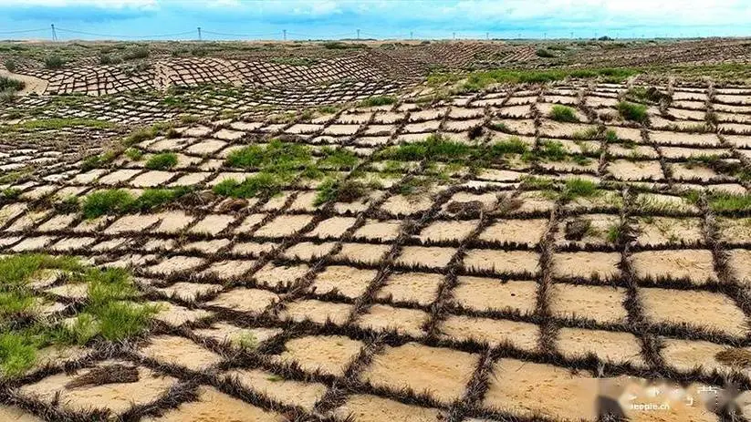
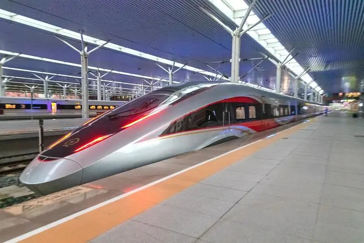
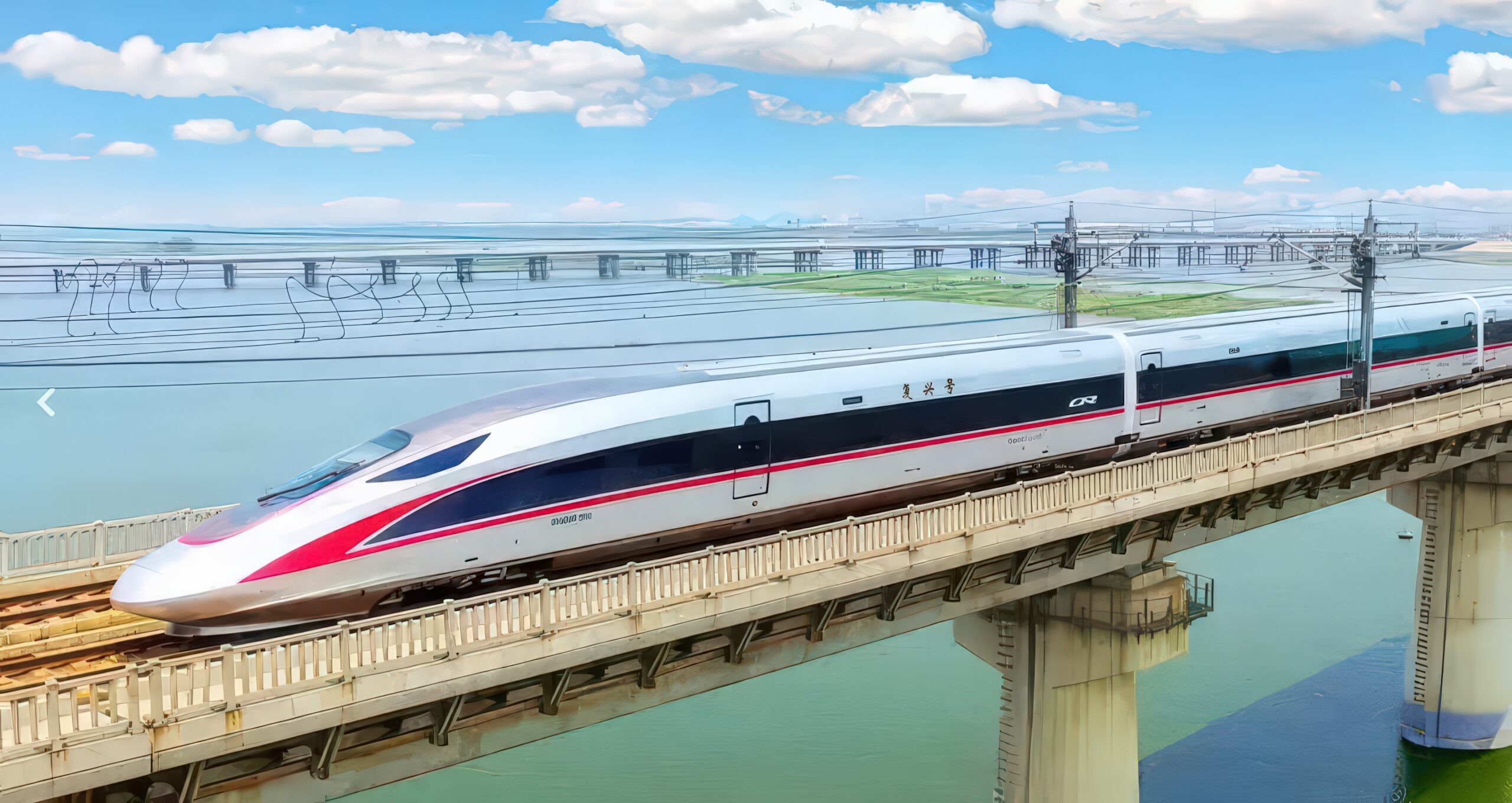
The country started modernization in 1978. It implemented the household contract system in the rural areas, and reformed the state-owned enterprises in the cities. The country designated the special economic zones and opened them for the foreign investment. It followed with more coastal cities and eventually the rest of the country. In 2001, China joined the WTO. It changed its development model to “made in China”. It built its skilled labor force, factories, and business parks. It upgraded its infrastructure, roads, seaports, and electric power generations. It built the largest high speed train network spanning from the coast to inland. The country also built the internet and ecommerce, and improved on the logistics. It was deeply integrated into the global economy. Fifteen years after the WTO, the country changed its development model to “design in China”. It automated the factories, upgraded the education institutions and elevated the workforce with higher education. It upscaled the industries with innovations and high tech. The country organized regions with city clusters. In the north region, it had the Jing Jin Ji city cluster. In the east, it had the Yangtze Delta city cluster, and the Greater Bay Area city cluster in the south. The country also embarked on the modernization of the countryside. It reduced the national poverty level to almost zero. It introduced new technologies and automation to the countryside and raised the farmer household income to a higher level. On the resources front, the country improved its pollution problems. Most of the rivers and lands now have acceptable water and soil quality. It sent the water from the south to the north to crunch its thirst. It also built tree belts along the Mongolian grasslands, in Xinjiang surrounding the Taklamakan Desert to combat the sand encroachment and the dust storms. All and all, the country is in a healthy economic state.
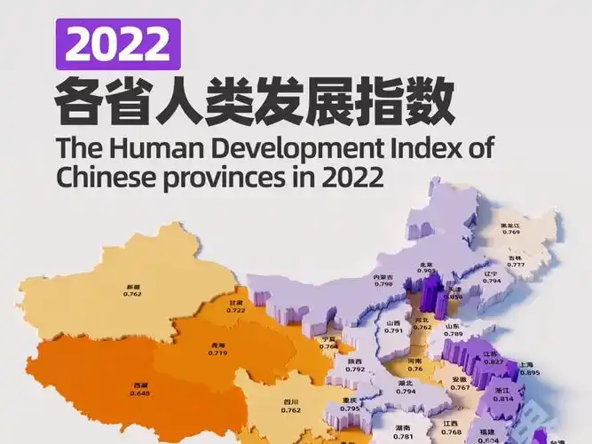
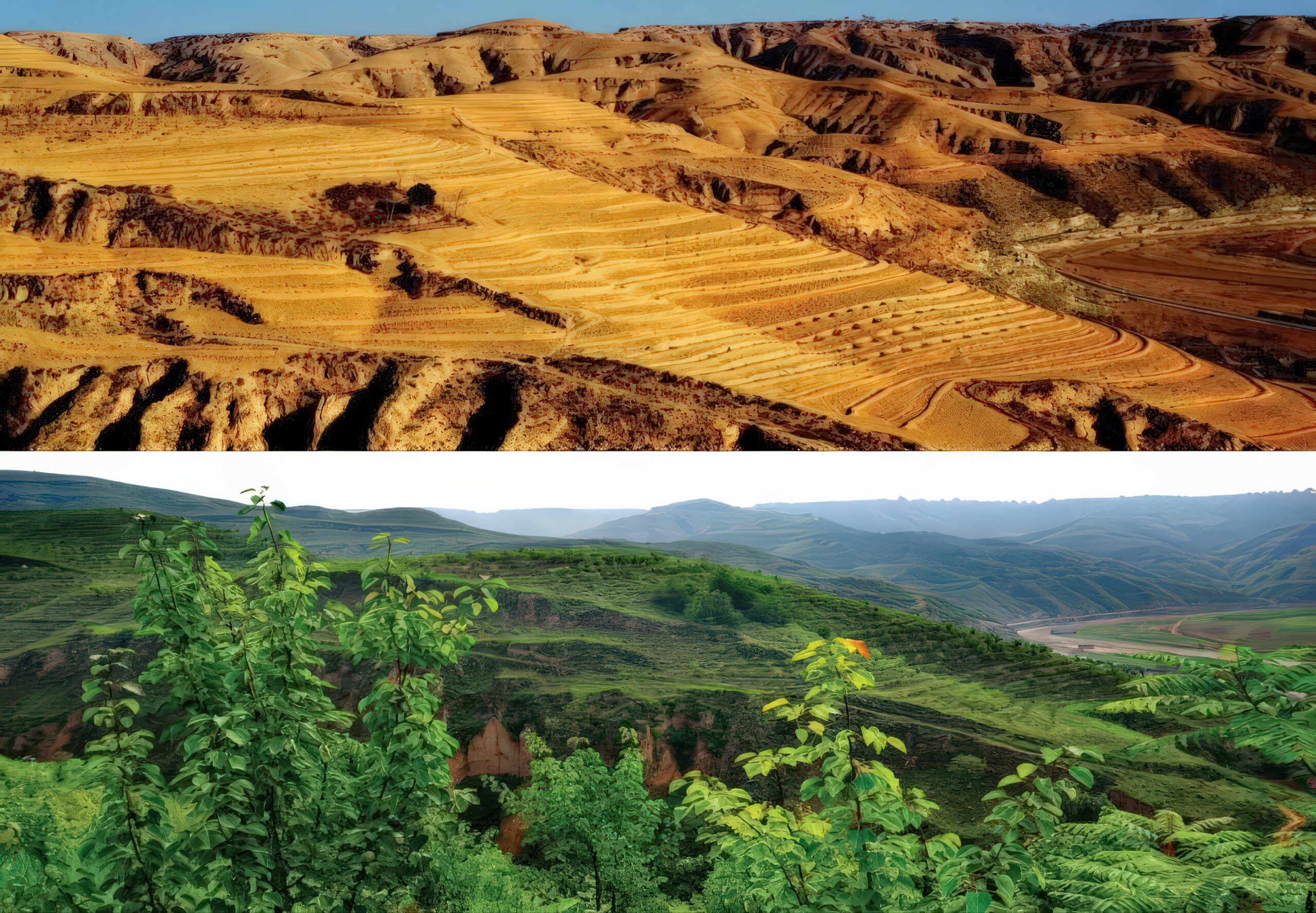
In this section (modernization section), you can explore the maps and the following stories: De-desertification – Map of areas implementing the de-desertification and their impacts. Loess Plateau Turns Green – Map of areas that have ecological improvements and their impacts. HS Train – Map of most High Speed Train routes and their stations. Human development metrics – Graphs showing China’s progression on the human development metrics in comparison with other countries. Top10 infrastructures – Map of infrastructures that rank top 10 in the world. South North Water Transfer – Map of two water transfer routes from south to north and their cities and scenic areas.